Home »

Heavy snow coming for Elk Valley and Kootenay Pass
Environment Canada today (Dec. 16) has issued a special weather statement warning of incoming snow to the Elk Valley, as well as a winter storm warning for Kootenay Pass and special weather statement for Roger’s Pass.
Snowfall with total accumulations of 10 to 25 cm is expected Tuesday evening through Wednesday afternoon in the Elk Valley.
“A moisture-laden Pacific frontal system will bring heavy snow to parts of the southern B.C. interior Tuesday night into Wednesday. Snow will intensify Tuesday evening and persist until Wednesday afternoon before easing as the system departs. Snow will begin late Tuesday afternoon and may transition to rain by Wednesday morning, resulting in slushy road conditions. Precipitation will ease by Wednesday afternoon,” Environment Canada stated.
“There is still uncertainty regarding exact snowfall amounts and the timing of the snow-to-rain transition in each region. Snowfall warnings may be issued as the situation becomes clearer. Prepare for hazardous travel conditions and allow extra time to reach your destination.”
Total snow accumulation of 30 to 40 cm is forecasted for the Highway 3 – Paulson Summit to Kootenay Pass corridor for late Tuesday afternoon through Wednesday afternoon, while total accumulations of 10 to 25 cm of snow is expected along the Trans-Canada Highway – Eagle Pass to Rogers Pass corridor.
“Significant snow accumulation will make roads and highways difficult to navigate. Near-zero visibility in heavy snowfall. Potential for transportation delays,” Environment Canada said.
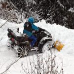
e-KNOW file photo
e-KNOW


