Home »

Proposed federal riding changes coming thanks to mathematics and borders
Kootenay-Columbia MP David Wilks is going to find he’s tacking more miles on his annual log when a boundary ‘redistribution’ of his riding takes place, as proposed by the Electoral Boundary Commission.
According to the commission, “Every 10 years, after the census is conducted, the number of electoral districts and their boundaries are revised to reflect population shifts and growth.”
The commission, meeting with elected officials this week and in early March, proposes the region’s federal riding should balloon west and envelope Creston, Salmo, Nelson and Kaslo, bringing its population to 107,058. It also proposes to relieve the riding of Nakusp and area.

However, despite the increase in size and change in the political make-up of his riding, Conservative MP Wilks says he understands the change.
“The commission’s had a tough decision to make because they were charged with increasing each of the ridings to about 105,000 people. The Kootenay-Columbia sits on the Alberta border, so it had to go west. They looked at going to the northern parts – Sicamous, Salmon Arm but that was definitely not going to work,” he told e-KNOW. “So the only place they could go was to the south and it made sense.”
Wilks said he knows some voters in the West Kootenay are not happy with the change but there was little option.
Indeed, the other Kootenay MP who is seeing big changes to his riding is not amused.
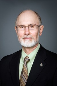
BC Southern Interior MP Alex Atamanenko (NDP) said he is disappointed that the Electoral Boundaries Commission’s report does not reflect the majority of submissions at last fall’s public hearings in B.C.’s rural ridings.
“This report goes against the submissions of an overwhelming majority of people who provided feedback at the Commission’s public hearings,” said Atamanenko. “We heard the message loud and clear that Nelson, Salmo and Kaslo did not want to be separated from Castlegar and Trail, but that is exactly what the Commission has done.
“What may work on paper does not translate to the reality on the ground.”
Geography will play a big role in governance for rural B.C., once again, Atamanenko said, noting the Commission has added significantly more mountainous area to the already challenging size of Kootenay-Columbia. Equitable access to the MP will be impossible in this large territory, he stated in a press release.
The Member for BC Southern Interior is slated to appear before the Committee in early March.
“I will be pleading my case against the changes to the riding boundaries and encourage everyone who is concerned to provide me with a letter of support. Letters from constituents will add weight to our case,” he concluded.
Wilks will be making his submission to the Commission on Feb. 27.
“I understand it is their final decision but it kind of makes sense to have that Slocan Valley and Nakusp in there but if they opt not to have it in, so be it,” he said. “If I am re-elected I will have an office in Nelson and we’ll go from there.”
 The Electoral Boundary Commission outlines the reasons for the decision on the new boundaries, beginning by explaining that the creation of a new riding could not be considered because of lack of population.
“The 2011 census population of the electoral districts contained between the Alberta border and the 49th parallel, north to Kamloops and the Shuswap, is 675,826. Ultimately, the Commission concluded that the addition of an electoral district in the Interior was not feasible.
“In drafting its proposal, the Commission was faced with the challenge of determining how to reconfigure the existing electoral district of Kootenay—Columbia, which demonstrated a variance of 16% below the electoral quota. The Commission determined that the only route of expansion was to the west. The proposal recommended crossing the Salmo-Creston (Kootenay Pass) and included the communities of Nelson, Salmo, Fruitvale and Montrose,” the report states.
“Submissions encouraged the Commission to keep Nelson, Castlegar and Trail in one electoral district. However, such a combination would have resulted in an electoral district with numbers well above the electoral quota. The Commission also received submissions to keep Nakusp, Central Kootenay K, New Denver, the Slocan Valley and Central Kootenay H in the same electoral district. As well, the Commission was advised that the proposal had the effect of splitting communities adjacent to Kaslo and the north end of Kootenay Lake.
“The Commission adopted several of the suggestions and has reconfigured the Kootenay—Columbia electoral district, which now includes most of the existing district plus the City of Nelson and adjacent areas. The Commission configured a new electoral district named South Okanagan—West Kootenay that includes Trail, Castlegar, Fruitvale and Montrose in its eastern region. The central portion of the district comprises the Kootenay Boundary area, and the western region incorporates Osoyoos, Oliver and Penticton.”
Wilks told e-KNOW he agrees that the redistribution is a bit boggling and he understands Atamanenko’s concerns, considering the basics of geography in the riding, noting he’s losing Nakusp “and yet I have Meadow Creek.”
There may seem to be arbitrary line drawing but to find the sought-after population, considering the Alberta provincial border barrier, there is little room for the Commission to move, Wilks said.
See Commission’s Report here:
See map of the riding: http://www.redecoupage-federal-redistribution.ca/bc/now/reports/03-bc_southern_map3.pdf
More on the Kootenay-Columbia: http://en.wikipedia.org/wiki/Kootenay—Columbia
Ian Cobb/e-KNOW
