Home »
Adequately so on California’s Lost Coast
 Road Trippin’ Lost Coast, California
California’s Lost Coast has an appropriate name.
A 70-mile (112 km) loop road between Humboldt Redwoods State Park/Highway 101 (near South Fork), to Petrolia and north to Ferndale proved to be a challenge to find, even though we were on it. And then a challenge to drive.
We’d been touring up and down the Avenue of Giants and I wanted to re-visit the Lost Coast Highway, having enjoyed the tour a few years before. That time we started in Ferndale and came out in the Humboldt redwoods.
So in a bid to reverse engineer the trip, we headed south to the access road. I was sure it was the right spot. Made sense. Looked at the map. Still made sense.
But the road sign read “Bull Creek Flats Road.” That meant nothing to me.
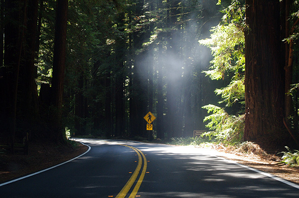 We saw a sign bragging about a giant redwoods trail known as Rockefeller Loop, so I thought, let’s go there. After a few miles we found the site but it was crawling with visitors. People were parking in the bush.
No place to park our car, we headed back to the road, now called “Lower Bull Creek Flats Road.”
I was looking for Mattole Road and had now believed I had boneheaded out and we toured back to Highway 101.
Had I turned left instead of right, I would have instantly discovered we were in fact on Mattole Road.
Back at Highway 101, my intense map perusal showed the road we had just driven HAD to be the right road. So back we went, harrumph harrumph.
 The tour restored, we wove uphill out of the redwoods and along tinder dry ridges and treed valleys, dodging an endless array of potholes and smelled a whole bunch of skunks whenever we passed by tall fenced properties.
“It’s Northern California; it’s legal – so I guess everyone is going for it,” I said as we crawled through a wee place like Bull Creek or Honeydew or Petrolia (site of California’s first oil well).
I had to keep my eyes glued to the road save having a tire or tires ripped to shreds.
That aside, the tour offers a lovely glimpse of coastal Northern California.
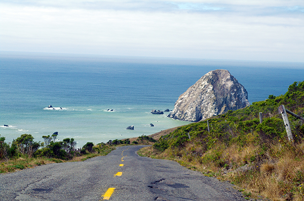
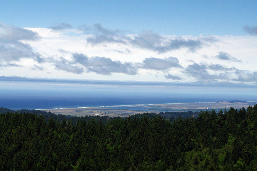
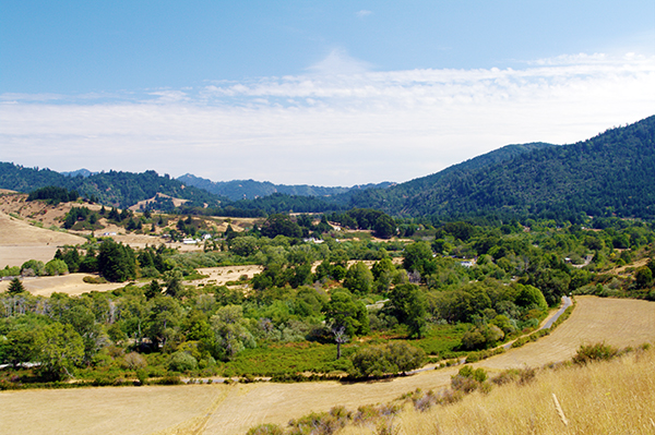 From the yellow/tan and green contrasts of Petrolia we wove down toward the lone coastal stretch of the road, along the Lost Coast and Cape Mendocino.
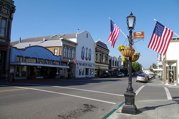
Then it is back uphill on the King Range, weaving and creeping over badly undulated sections of highway, the work of plate tectonics in an area considered the most seismically-active in California, along a ridge or two and then curve downhill to Ferndale, with it’s lovely heritage (Victoria) downtown.
The Lost Coast Highway as it was once marketed (not sure if it still is, for perhaps some skunky reasons) is a trip I would have enjoyed (like I did the first time) were it not for the crummy road conditions.
But it turns out the area is part of the Emerald Triangle, a locale where an estimated 80% of America’s high-grade cannabis is grown.
 “Trimigrants” as cannabis bud trimmers are known as in the area, were everywhere in Redway as we passed through on our way to Shelter Cove, a marvellous wee place perched aside the ocean 21.5 winding and steep (at the end) miles (34.5 km) to the west, the day after we toured Lost Coast Highway.
The Netflix program Murder Mountain provides an interesting and disturbing glimpse into an aspect of the Emerald Triangle, which includes the southern half of the Lost Coast area.
Our photo/video presentation features images of the Lost Coast Highway and Humboldt Redwoods State Park, as well as Shelter Cove, which is accessed 21 miles south of the Bull Creek Flats Road access to the Lost Coast Highway. The stretch of coast from Shelter Cover north to Cape Mendocino is known as the Lost Coast.
 So now armed with the knowledge not to get too nosey and to be aware of some tire-shredding road conditions, venture forth to the Lost Coast and get an eyeful of coastal Northern California’s natural beauty along an adequately named highway.
Budget four hours to complete the loop (in either direction).
Photos and video by Carrie Schafer and Ian Cobb
Lead image: Sugarloaf Island off Cape Mendocino. Ian Cobb photo